In Tableau Desktop 2026.2 Salesforce have introduced a way to see drive time. Previously you could select points within a radius or free-form selection area. And you could use spatial calcs / joins to find points within a certain distance “as the crow flies”. But you couldn’t natively see how many points were within a 30 minute drive of a given point.
With the drive time selection function you now can:
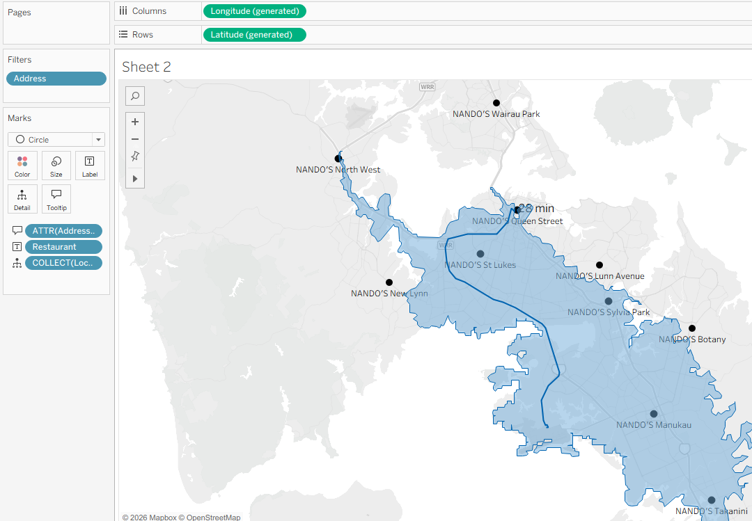
In the above example I have clicked on a point at Auckland Airport and dragged out for 28 minutes drive time towards Nando’s Queen Street restaurant. The tool has followed the road network for 28 minutes, and also plotted an outline of how far I could reach along any roads from the airport if I drove for 28 minutes, showing me I could actually reach any of five Nando’s restaurants.
Here’s how you can use the functionality:
- Download version 2026.2.
- Create a map with points and data.
- Select the drive time selection / lasso from map options (top left of map).
- Click a location and drag out for the desired time (up to 60 mins).
- Any points within that drive time are selected.
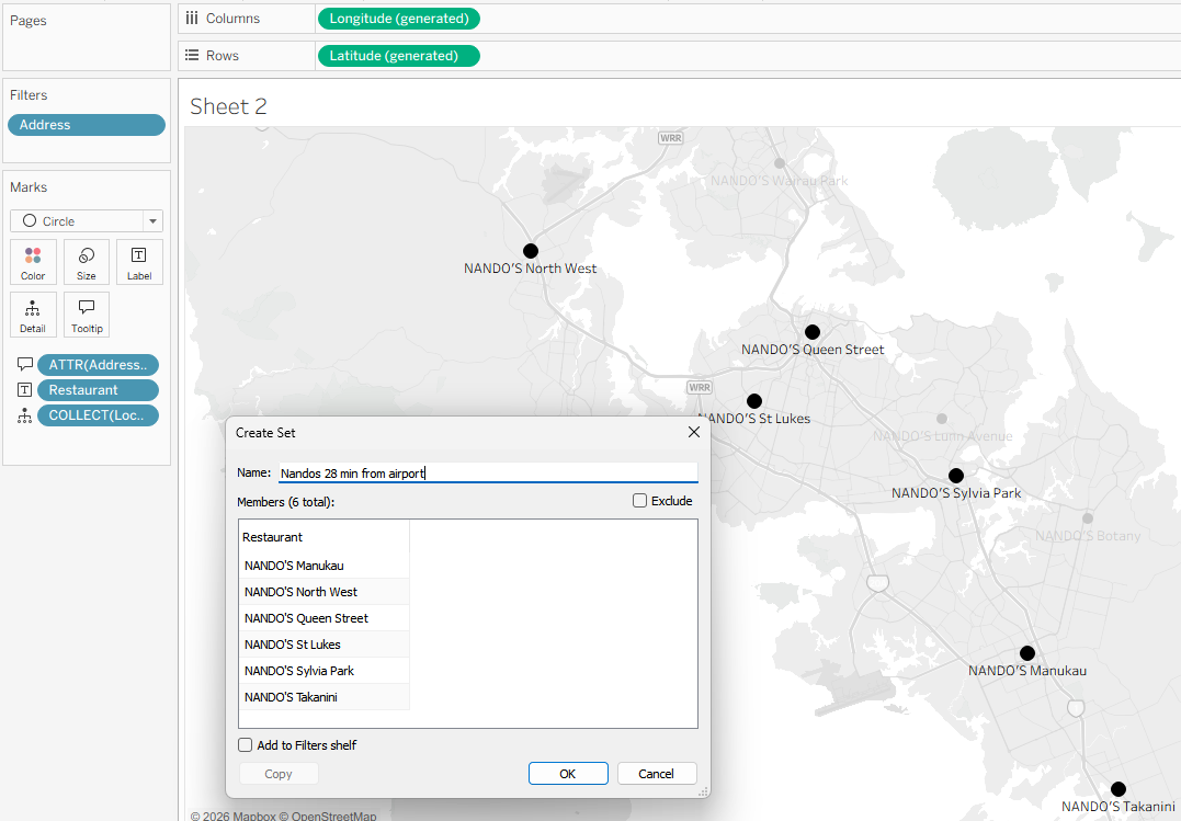
- You can then do things like create a set for further visualisation, analysis or presentation:
Some more detail…
Check out the product help page: Analyze Marks on a Map with Drive Time. And the feature launch message in the Tableau Community Slack workspace (NB: the Slack workspace requires sign up) for more details.
At the moment the selection area (polygon) doesn’t persist; it disappears after a few seconds. It sounds like being able to persist the area/polygon will be a fast-follow enhancement. In the meantime I found that you can use a screenshotting tool that allows for delayed screengrab (e.g. the Windows Snipping Tool). Set the timer for a delay that will allow you to make your selection in Tableau, make the selection and keep hold of the mouse button / tracker pad until the screenshot tool activates, now do your screenshot.
Under the hood Tableau is generating the isochrones (areas) using a MapBox API. Discussions indicate that it using average drive time mapbox/driving rather than current drive time based on current traffic conditions mapbox/driving-traffic. This makes sense to me, as most analysis use cases are likely to be looking at general time rather than a specific travel date and time. It’s also worth noting that the API and Tableau restrict to a maximum travel time of 60 minutes.
Happy mapping! (or commiserations, if like me you found that Nando’s was still too far away)